Santpetru Lempes – Lempes Hill
| GPS coordinates : | take off : 45°43’2″ (45.7174)N; 25°39’12” (25.6534)E – Elevation : 622 m. landing : 45°43’0″ (45.7168)N; 25°38’49” (25.647)E – Elevation : 524 m. |
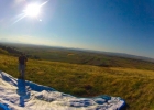
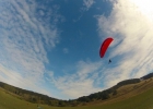
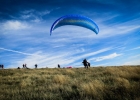
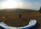
| Take off : | This is a small, 120 m high hill, suitable for both beginners and advanced paragliders. |
| Landing : | On the N, NW and W directions, is suitable for everybody. On the E direction, the landing place is either the takeoff place, of small roads between trees. The landing place on E is suitable for advanced paragliders only. |
| The hill is in Sanpetru village, 3 km away from the city of Brasov, coming from Bucharest, you pass the train station and at the first traffic light, you turn right, and keep going straight ahead, until you reach the village. |
Lempes Hill: 650 m
Takeoff: N 45 ° 43 ‘00.58 “E 025 ° 39’ 01.03”
Altitude: 650 m
Orientation: flight direction, S-V, V, E
Description: There are 3 levels of takeoff:
120m on south direction
85m, 65m, 45m to the west
85m on the East
Access: You can climb to the top of the hill with your car without problems.
Landing: N 45 ° 36 ‘18.6 “E025 ° 39’ 33.4”
Description: Landing is high as the eye can see on the Northwest and on the East is an orchard.
Features: Hill school, training and performance, with very good possible flight distance dynamically
Location: Access: Sanpetru village 7 km from Brasov in the direction of BOD.


